| Encyclopedia of Tours and Travel to Maharashtra, featuring information on Fairs & Festivals, Wildlife, Excursion, Adventure and Weather of Maharashtra. |
 |
 |
 |
 |
 |
 |
 |
||
|
Mumbai
Forts
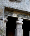
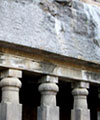
Bassein Fort In the 18th century, the fort was attacked by the Maratha army under Peshwa Baji Rao, and fell in 1739 after a three year long campaign. Bus or taxi from the Vasai railway station can reach the remains of the fort. The ramparts overlook Vasai creek and are almost complete, though overgrown. Several watchtowers still stand, with safe staircases leading up. The Portuguese buildings inside the fort are in ruins, although there are enough standing walls to give a good idea of the floor plans of these structures. Some have well-preserved façades. In particular, many of the arches have weathered the years remarkably well. They are usually decorated with carved stones, some weathered beyond recognition, and others still displaying sharp cut marks. Three chapels inside the fort are still recognisable. They have façades typical of 17th century Portuguese churches. The southernmost of these has a well-preserved barrel vaulted ceiling. Castella de Aguada In 1739 the island was invaded by the Maratha Empire and was subsequently ruled by them until 1761 when the British evicted them off the island. With the purpose of the fort now no longer necessary, it began to decay. Remnants of the fort still exist, though most of it is rubble. Dongri Fort Madh Fort It is located in Madh Island. It is secluded and difficult to reach, about 15 km from Malad. Some Bollywood movies like Love Ke Liye Kuchh Bhi Karega are shot at this location.
Mahim Fort In 1684, the fort was strengthened by Sir Thomas Grantham. In 1772, the Portuguese attempted to attack this fort, but they were repelled by the British with cannonballs. The Mount Mary's Bascilica also was damaged during this encounter. According to accounts, the fort had 100 soldiers and 30 cannons then. The fort lies off the Mahim Causeway, which links the suburbs to the city. The mushrooming of slums and encroachment around the fort has lead to it being in a dilapidated state, with cracks appearing. Tidal changes in the Mahim Creek have also contributed to structural changes. The Bandra-Worli Sea Link poses a threat to it. Mazagon Fort Riwa Fort Sewri Fort In 1769, Yadi Sakat of Janjira had conquered the Sewri and Mazagon Forts. It had a garrison of 50 sepoys under a subedar, and was probably equipped with 8-10 cannons. It's famous had cannons repelled a Portuguese attack in 1772. The fort is currently owned by Maharashtra State's Department of Archaeology and Museums. Classified as a Grade I heritage structure, the fort is currently in a dilapadated condition with overgrown weeds. A Rs. 75 lakh (7.5 million) makeover is planned along with a corridor to watch the flamingoes that reside in the nearby marshes. Architectural highlights include a pentagonal room along with a long domed corridor, and linear vaulted structures Sion Hillock Fort At the base of the hill is the branch office of the Archaeological Survey of India, and a garden - the Pandit Jawaharlal Nehru Udyan. The fort is dilapidated and a collection of broken stone steps, scattered walls and ruins, overrun by trees and ground cover. The fort wall has a small room on top with wooden trussed ceiling of old tree trunks. A series of pathways lead to it. The fort offers a panoramic view, overlooking the salt pans in the Thane Creek. However vandalism and apathy have taken toll on the structure. Nearby forts include the Riwa Fort and Sewri Fort. Worli Fort The upkeep of the fort has been impossible due to its inaccessibility, as the roads leading to it are completely blocked by illegal hutments that have cropped up over the years, only to be overlooked by the local authorities for the sake of electoral gain and bribes paid for allowing illegal constructions. The fort is completely in ruins today and a slum has enveloped the edifice, making it a den for illegal activities like the brewing of illicit liquor within its confines. A bell tower peeps out of the ruins and the ramparts are used to dry clothes. Historians have often called for the protection of the area but their efforts have fallen on deaf ears. This in spite of an NGO claiming to have adopted the Worli Village, where the fort is located. One ray of hope is the new Bandra-Worli sea link that will skirt around the Worli peninsula, bringing the fort back into the public eye, and hopefully, will lead to some action from the government. |
|||||||||
|
|||||||||
|
|||||||||
|---|---|---|---|---|---|---|---|---|---|